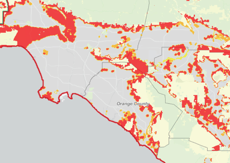
Here’s how many acres most of Southern California’s cities changed on Cal Fire’s risk map
Mapping fire threats Cal Fire released new fire hazard severity maps for Southern California on Monday, March 24, the final piece in a 2025 statewide rollout. While Cal Fire mapped “very high” wildfire zones under local authority more than a decade ago, the new maps now include “high” and “moderate” zones as well. The state…
Read more