
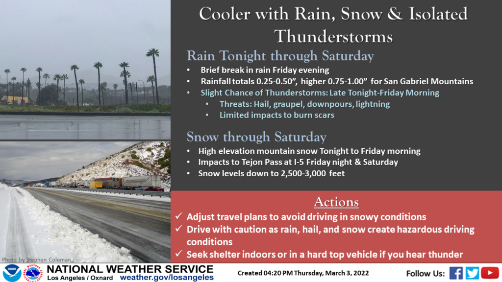
LOS ANGELES — Rainy, cold conditions are moving into Southern California Friday morning and are expected to persist through Saturday — bringing snow levels as low as 3,000 feet, along with a winter weather advisory for the L.A. County Mountains, according to the National Weather Service.
A line of heavy showers and scattered thunderstorms were approaching the mountains of Los Angeles County, and portions of the Santa Clarita Valley and Antelope Valley. Doppler radar was tracking the showers and thunderstorms from east of Santa Clarita to Mount Wilson and Falling Springs.
Winds are expected to be in excess of 40 mph with pea size hail.
Gusty winds could knock down tree limbs and blow unsecured objects, causing minor damage to outdoor objects. Heavy rain could cause minor mud and debris flows in and near the Bobcat, Ranch 2, and Dam burn areas.
Lightning strikes are occurring with the storm. There were an estimated 75 lightning strikes since midnight in Southern California, with another 28 in-cloud flashes.
Van Nuys has recorded .37 inches of rainfall as of 4 a.m., according to the National Weather Service. Northridge recorded .18 inches and Hansen Dam recorded .16 inches. Newhall recorded .11 inches and the Santa Fe Dam in the San Gabriel Valley recorded .13 inches of rain.
The conditions will be driven by two weather systems bearing down on the region — the first expected to bring inclement weather Friday, along with mountain snow and a slight chance of thunderstorms.
Meanwhile, a second, colder system will move in Saturday and continue into the evening, bringing “another chance of showers to the area.”
Rainfall totals today are expected to be relatively low, with most areas receiving a quarter- to three-quarters of an inch of rain, although the San Gabriel Mountains could get slightly more, forecasters said.
There will be a slight chance of thunderstorms developing, possibly resulting in localized “brief heavy downpours and small hail.”
Forecasters said temperatures in much of the area Thursday were 10-15 degrees lower than Wednesday, and temperatures could dip another 5 to 10 degrees today, when temperatures will average about 10 degrees below normal.
Saturday’s cold front should bring more showers as well as more snow in the mountains — with the snow level possibly dropping as low as 3,000 feet, and temperatures falling a few more degrees, keeping most of the region in the mid- to upper 50s.
A winter weather advisory will be in effect until 10 a.m. Sunday in the Los Angeles County Mountains, excluding the Santa Monica Range.
The weather service said 6 to 12 inches of snow was expected in the Ventura and Los Angeles County Mountains — with the heaviest accumulations in the eastern San Gabriel Mountains.
In addition, winds gusting to 50 mph were expected in that area, especially Friday and Saturday nights.
The weather service said to expect slippery road conditions along Interstate 5 over the Grapevine, Highway 33 through the Grapevine and Highway 2 through the San Gabriel Mountains.
Forecasters said conditions should begin to rebound on Sunday with clear skies. Warmer weather is expected to return by Monday.
Related Articles
Southern California braces for rain, thunderstorms — and perhaps more hail
Cooldown, thunderstorms coming to Southern California this weekend
Anaheim registers highest temperature in the U.S. on Monday
Mapped: Just how cold was it Thursday morning in Southern California?
Southern California weather forecast shows more freezing temps Friday, warm up by the weekend
Recent Comments