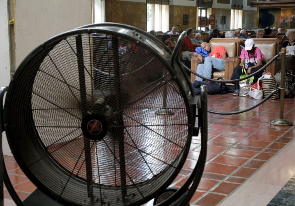
Punishing triple-digit heat continues to bear down on Southern California, with a fifth straight Flex Alert in effect Sunday urging residents to conserve electricity during peak hours.
It was 96 degrees at John Wayne Airport as of 9:18 a.m. But it felt like 103 degrees, the National Weather Service said in a tweet. The normal temperature would be 81 degrees.
Current Heat Index Values:
– San Diego International: 88
– Carlsbad: 90
– John Wayne International: 103
– Fullerton: 100
– Ramona: 97
– Camp Pendleton: 102
– Palm Springs: 102
– Brown Field: 95
— NWS San Diego (@NWSSanDiego) September 4, 2022
Excessive heat warnings remain in effect until at least 8 p.m. Tuesday for the mountains and the Santa Clarita, San Fernando and San Gabriel valleys, along with the inland coastal area, including downtown Los Angeles.
The warning in the Antelope Valley will last until 9 p.m. Wednesday, with temperatures anticipated up to 113 degrees.
Forecasters also warned of possible monsoonal thunderstorms Sunday across the mountains, deserts and portions of the valleys. Potential threats include heavy downpours with localized flooding, strong wind gusts over 50 mph, hail, and frequent lightning.
The National Weather Service called for a 20% chance of showers and thunderstorms Sunday afternoon in the San Gabriel, San Fernando, Santa Clarita and Antelope valleys.
On Saturday, record temperatures were recorded in Lancaster, Palmdale and Sandberg. Lancaster’s 109 was one degree higher than the previous record of 108 set in 1955. Palmdale’s 106 tied the record set in 1947 and in the Antelope Valley community of Sandberg, Saturday’s 99 degrees broke the previous record of 97 degrees, set in 1955.
Sunday was shaping up to be even hotter, with highs of 102 expected in downtown Los Angeles, 107 in Pasadena, and 110 in Van Nuys and Santa Clarita.
In Orange County, excessive heat warnings are also in place through 8 p.m. Tuesday for coastal and inland areas and the Santa Ana Mountains and foothills. Forecasters said Orange County beaches will be in the upper 80s, with Santa Ana expected to reach 101 degrees, Anaheim 103 and Fullerton 104.
Overnight lows are not offering much relief either, staying in the 70s and even in the low 80s in some of the hotter areas.
“A prolonged period of very hot conditions with minimal coastal clouds is expected as high pressure aloft remains anchored over the West,” according to the National Weather Service. “Triple-digit heat will be common for many valley and mountain locations through early next week. Record-breaking heat will produce a very high risk of heat illness.”
“Drink plenty of fluids, stay in an air-conditioned room, stay out of the sun, and check up on relatives and neighbors,” the NWS urged. “Young children and pets should never be left unattended in vehicles under any circumstances.”
Forecasters also urged residents to be aware of the signs of heat stroke and to take precautions.
“Take extra precautions if you work or spend time outside,” according to the NWS. “When possible reschedule strenuous activities to early morning or evening. Know the signs and symptoms of heat exhaustion and heat stroke.
“Wear lightweight and loose fitting clothing when possible. To reduce risk during outdoor work, the Occupational Safety and Health Administration recommends scheduling frequent rest breaks in shaded or air conditioned environments. Anyone overcome by heat should be moved to a cool and shaded location.”
The California Independent System Operator — which manages the state’s power grid — issued the statewide Flex Alert from 4 to 9 p.m. Residents are urged to take the following power-saving steps:
setting thermostats to 78 degrees or higher;
avoiding use of major appliances;
turning off unnecessary lights; and
avoid charging electric vehicles.
Residents are also advised to pre-cool their homes as much as possible and close blinds and drapes to keep interiors cool.
The alerts have worked thus far, with the state avoiding involuntary power cutoffs. Officials said Sunday, Monday and Tuesday in particular are shaping up to be the most difficult days of the heat wave. Tuesday’s peak demand is forecast to be 50,087 megawatts, just shy of the all-time record of 50,270 set in 2006.
According to Cal-ISO, electrical demand on Saturday was 45,829 megawatts, and the forecast for Sunday was about 45,000.
Triple-digit highs are expected to last through most of the week, with no significant cooling until Saturday.
Related Articles
Seek alternate routes to 5 Freeway near Route fire in Castaic: Caltrans
Huntington Beach jewelry store owner exchanges shots with armed robbers
State issues Flex Alert for 5th day on Sunday
Woman killed when 50-foot boat sinks off Catalina Island
3.6 earthquake near Mira Loma rattles parts of Southern California
