
The brunt of the last in a string of storm systems that have deluged Southern California made its way through the region on Monday, Jan. 16, with lingering showers expected to make way for sustained dry weather beginning on Tuesday, Jan. 17.
The tail end of the lesser of two storms that brought yet another round of record rainfall over the weekend to a rain-battered stretch continued to lead to some hazardous driving conditions and weather-related issues early Monday, along with a continued high-surf advisory.
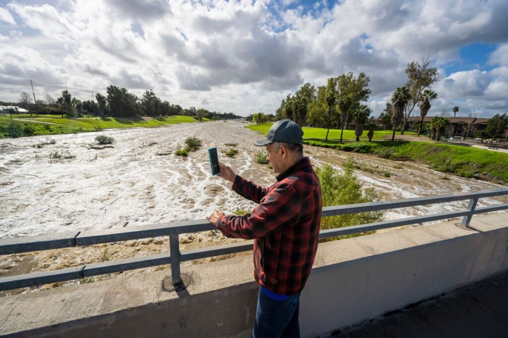
It was a far cry from the torrential rains early Saturday.
In Orange County, the two-day rain totals ranged from just shy of two inches, to a little above four inches in the coastal areas and above six inches in portions of the mountains. In San Bernardino and Riverside counties, the range was two inches to above three in the valleys and nearly six and a half inches in some mountains.
Record-breaking rainfall was also recorded in Los Angeles County on Saturday, including in Long Beach, which collected 1.72 inches, and downtown Los Angeles, which caught 1.82 inches.
Even as the worst of the storm passed, the wet and windy weather still led to some trouble late Sunday into early Monday.
In Orange County, a man barely hanging onto an embankment was rescued from a storm channel in Cypress near Knott Avenue and Recycle Way shortly before 6 p.m. Sunday by firefighters.
Hours later, a large tree fell in the Hollywood Hills and ruptured a gas line, downed power lines and damaged a home.
Farther inland, a rock slide early Monday on Highway 74, between Mountain Center and Hemet, snarled traffic, while hazards such as mud and standing water led to multiple road closures throughout unincorporated areas of Riverside County.
While the breezy winds may remain, the last remnants of the wet weather in Southern California was expected to taper off by mid-day Tuesday to the latest, and drier days were forecast into next week, at least.
“The parade of storms we just experienced is pretty much over and we are back to a dry period,” said Kristen Steward, a meteorologist with the National Weather Service.
After a three-year stretch that marked the driest in California on record, forecasters said the wet start to the new year could be a good sign for the parched state.
But then again, they also cautioned that the first few months of California’s previous water year — which runs from Oct. 1 to Sept. 30 — also saw a significant amount of rainfall before the state settled into extended dryness.
“This time last year we were roughly in the same position,” said Samantha Connolly, another meteorologist with the National Weather Service.
The break in the wet weather is expected to give local officials time to clean up and assess the full impact of recent storms, which saw Gov. Gavin Newsom and President Joe Biden declare states of emergency for at least parts of California. Los Angeles Mayor Karen Bass declared a local state of emergency as well.
City News Service contributed to this report.
Related Articles
California storms photos: Floods, mudslides, rescues, sinkholes
Mapped: Orange County’s wettest spots from weekend rainstorm
With brief respite from rains, Rose Bowl Half Marathon, 5K weave through Pasadena
Southern California sees record rainfall – with more on the way
First of back-to-back storms starts in Southern California