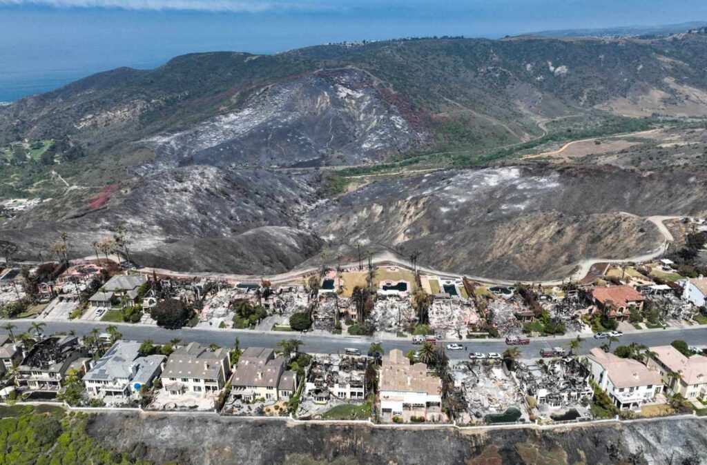
As fire crews worked Monday to get the last bit of containment on the Coastal fire, fresh drone images taken show the damage the Laguna Niguel neighborhood will be recovering from.
Temporary flight restrictions put in place to keep unwanted distractions from the local skies as firefighting aircraft worked on the blaze were removed by the FFA over the weekend. A drone flown by an Orange County Register photographer on Monday give an overview of destruction suffered.
The brushfire that ignited Wednesday and quickly moved up a canyon wall to a ridge of homes above destroyed 20 homes and damaged another 11. As of Monday evening, the Orange County Fire Authority reported the fire was 90% contained and remained at 200 acres burned.
Related Articles
More Coastal fire evacuation orders lifted in Laguna Niguel
Drones hunting down hot spots of Coastal fire that ravaged Laguna Niguel neighborhood
Coastal fire a harsh reminder that fire season is longer, more intense
Even before Coastal fire, hilltop dwellers worried, sought better ways to manage risks
Hundreds allowed back to homes in Laguna Niguel as Coastal fire is 40% contained
